

Wyandotte History
Wyandotte (also known as Oakdale) is a neighborhood on the southside of Louisville. Its boundaries are Longfield Avenue to the north, Taylor Boulevard to the west, I-264 to the south, and Southern Parkway to the east. The opening of Iroquois Park in the early 1890s created a huge demand for suburban homes south of Louisville. The Coleman-Bush company had begun selling lots in a subdivision called Oakdale in late 1890. Oakdale was one of many middle-class communities created at this time, facilitated by the southward extension of streetcar lines. It was officially renamed Wyandotte in the 1970s. Around 1904, Wyandotte incorporated Central Avenue which is the home of the historical Churchill Downs, as part of the community. The neighborhood received more recognition now because of its connection to the famed track and thoroughbred racing. Central Avenue is the high-life of the area and hosts Cardinal Stadium, and also the Kentucky Derby Museum which opened in the spring of 1985.
Wyandotte Neighborhood Statistics
Median Home Value: $69,413
Median Rent: $892
Median Household: $35,513
Population: 4279
Rent vs. Own:

*Data Sourced from Niche.com. Please click here for information on all the data sources used by Niche.com.
Top Public Schools Serving Wyandotte
- DuPont Manual High School
- J. Graham Brown School
- Louisville Male High School
- Greathouse Shryock Traditional Elementary School
- Barret Traditional Middle School
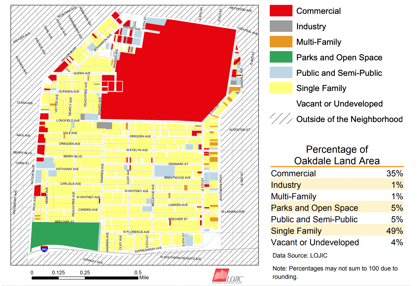
For additional statistics on the Wyandotte (aka Oakdale) neighborhood, please review the Oakdale Neighborhood Profile created by the Kentucky Data Center in partnership with the University of Louisville and Metro United Way.
*Data Sourced from: Kentucky State Data Center